


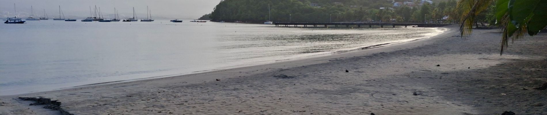
Anse à l'Ane - Anse Mitan par Fort d'Alet.

Lamartiniere
User GUIDE
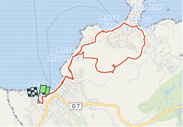


2h35
Difficulty : Easy

FREE GPS app for hiking
 SityTrail
IGN / Geographical institutes
SityTrail Plus
The world is yours!
About
Trail Walking of 7.5 km to be discovered at Martinique, Unknown, Les Trois-Îlets. This trail is proposed by Lamartiniere.
Description
Petite rando entre Anse à l'Ane et Anse Mitan, Les Trois-Îlets. Permet d'apprécier ces deux secteurs avec plages et quartiers, voire également le Fort d'Alet, la Baie de Fort-de-France ainsi que la végétation y afférente. Rue du Dauphiné, plage Anse à l'Ane, secteur boisé, passage près le Fort d'Alet, Glacy, plage Anse Mitan, retour via morne d'Alet, plage Anse à l'Ane, montée vers hôtel Panoramique. Fort d"Alet, domaine militaire, accès réglementé.
Photos


Positioning
Comments